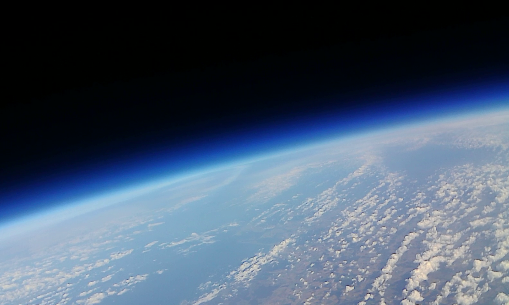
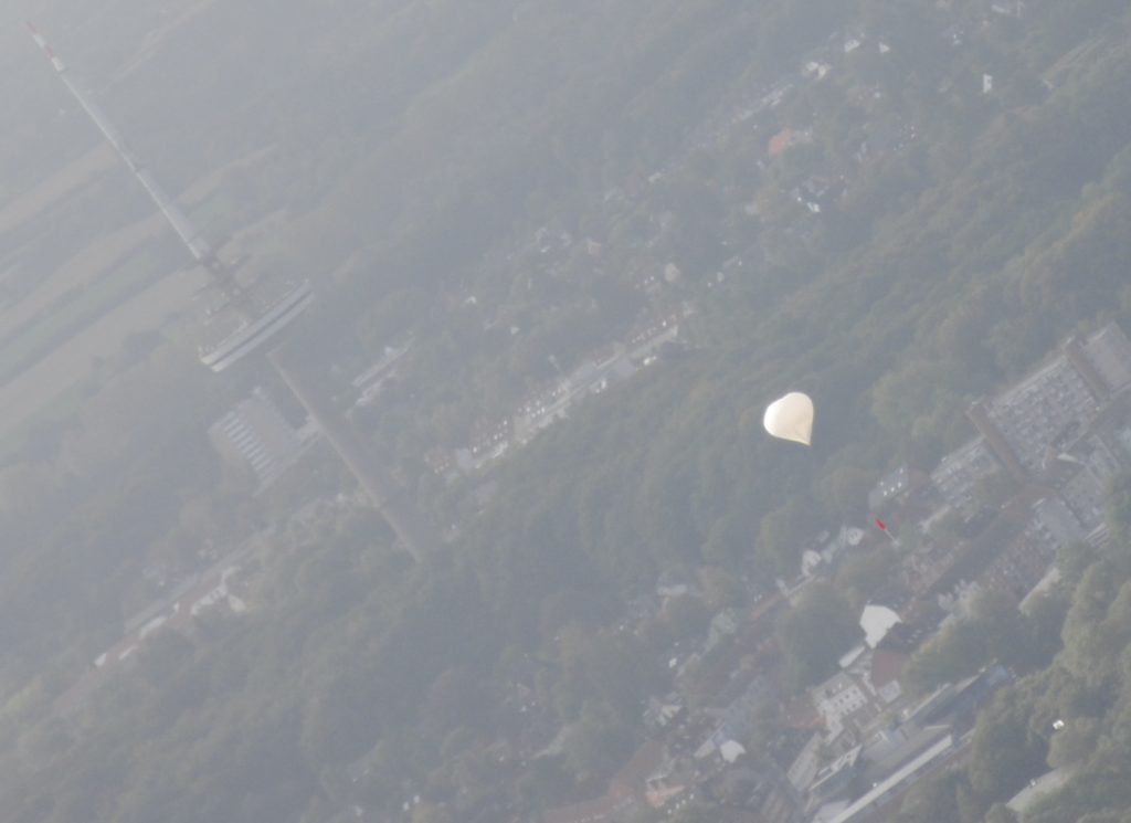
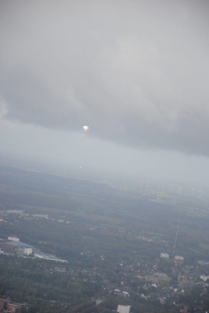
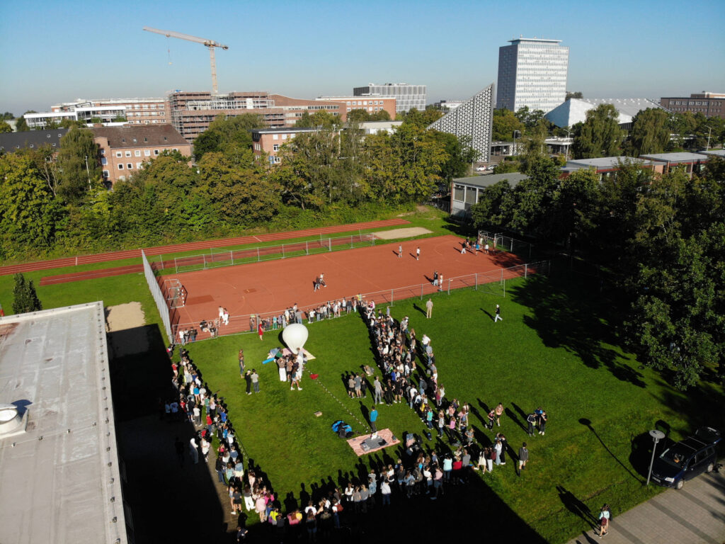
We successfully launched a weatherballon with our instrument CHAOSjunior as part of “Highlights der Physik”, a science festival taking place in Kiel. The clear blue sky allowed a launch at around 11:45 am. Many spectators followed the launch and interesting questions were asked, especially by kids. We even had a send-off by a friend and colleague from the Department of Extraterrestrial Physics who accompanied our ballon with his plane. He took the pictures of the balloon from the air. Currently, we are on our way to Rostock to recover CHAOSjunior. Stay tuned for further information on CHAOSjunior and visit our social media channels and the channels of “Highlights der Physik”.
Es sieht hoffnungsvoll aus, daß wir am Samstag Mittag starten können. Die Wettermodelle sagen etwas blauen Himmel voraus und eine Landung zwischen Rostock und Stettin.
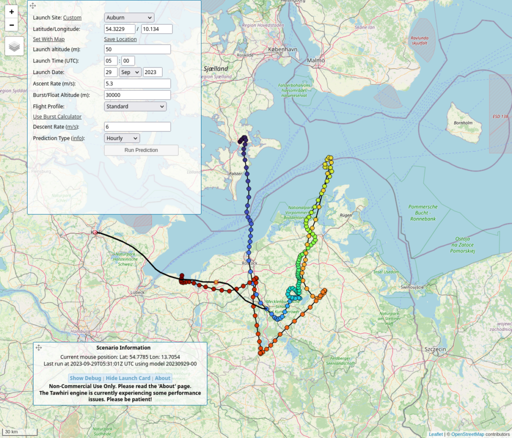
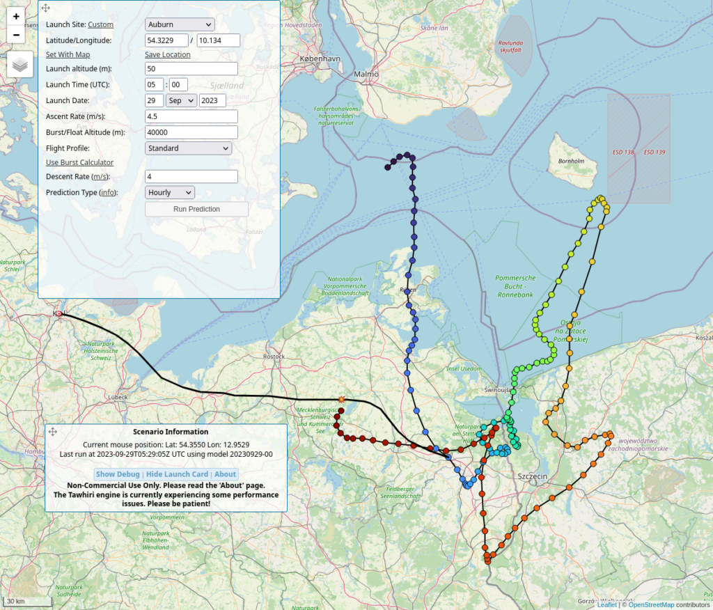
Gezeigt sind die Landeorte je nach Startzeitpunkt. Angefangen heute um 7 Uhr, wenn die Landung noch mitten in der Ostsee passieren würde, wie während der ganzen letzten Woche. Die eingezeichneten Flugrouten sind für Starts um 12 Uhr am Samstag. Einmal links, für einen kurzen Flug, wenn der Ballon sehr früh platzen sollte, schnell aufsteigt, und der Fallschirm verheddert kaum Wirkung zeigt. Zum anderen rechts, wie die meisten Flüge bisher verlaufen sind, der Ballon platzt unerwartet spät in 40km Höhe.
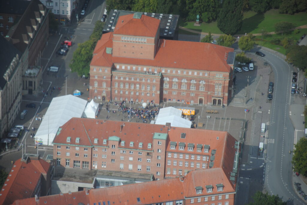
Morgen, am Samstag werden um 10 Uhr die Startvorbereitungen auf dem Rathausplatz beginnen. Der Start sollte dann zwischen 12 und 13 Uhr passieren, sobald genug blauer Himmel zu sehen ist und die Flugsicherung die Starterlaubnis erteilt.
Diese Sonde mit Fallschirm sollen fliegen. Darin ist ein Instrument zur Messung primärer und sekundärer kosmischer Strahlung.
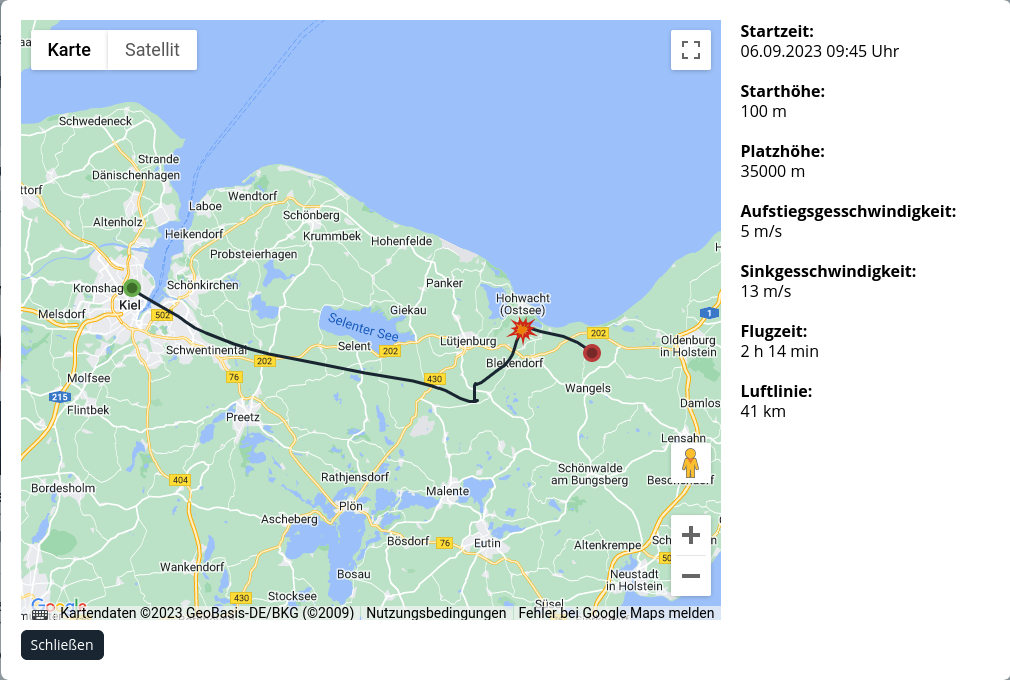
Last Wednesday, September 6, the Ricarda-Huch-Schule in Kiel launched their third Weatherballon mission.
And just as with the last two missions, this mission ended in the water as well. We filled an extra large volume of Helium into the balloon, 93bar×50l, to make sure it would rise fast and burst early, to safely land close to Oldenburg in Holstein.
That was the prediction. We reached 5m/s rise speed, but the balloon burst at 40.7km height, five kilometers higher than predicted. The real flight dropped our sensor box about six nautical miles east of Dahme.
Of course, we did not know about that at first. We spend the time waiting for the GPS trackers to come in range in an ice cream cafe in Lensahn. When the satellite radio tracker finally send the first messages descending into GPS range below 10km height, we got the first idea that the track may be way to far east. The message after touchdown confirmed that. The satellite radio tracker did not send further messages, because the box was floating at very low speed that did not trigger the motion alert. Anyhow, we went to Grömitz and hired a boat to look for it. The boat with one teacher and three pupils returned empty handed after more than five hours.
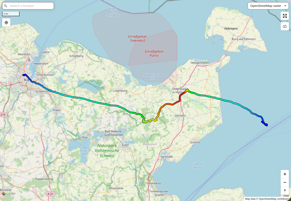
The next morning, we got a scheduled daily message from the tracker, the box drifted north over night. Shall we make a hike along the beaches from Dahme to Großenbrode? No, the next morning the box reached the Fehmarn Belt and set of to continue through the Store Belt. But here the currents were so fast, that we got new positions every five minutes. Another boat was put behind a car, went to Fehmarn, launched into the water and picked the box out of the water.
What did we find inside the box? The electronics was mostly destroyed by some salty water and the voltages still applied. The SDcards of the video camera and the primary payload, an Arduino reading the pulses from a Geiger-Müller counter, were readable. But the Arduino stopped working properly before the balloon launched. There was no data except for an hour before launch. The raw video awaits processing and compression. The STRATO3 datalogger is in very bad shape. Its SDcard is very exposed and the contacts were eroded. Two contacts were gone. But that has never been a problem in the past. We scratched the plastic a little, exposed all contacts, and soldered an adapter to the card, that could be inserted into an SDcard reader. The data was fully recovered, covering the whole flight. That is how we know where our balloon was flying. The datalogger has a specially hacked GPS chip, that works up to a height of 50km.
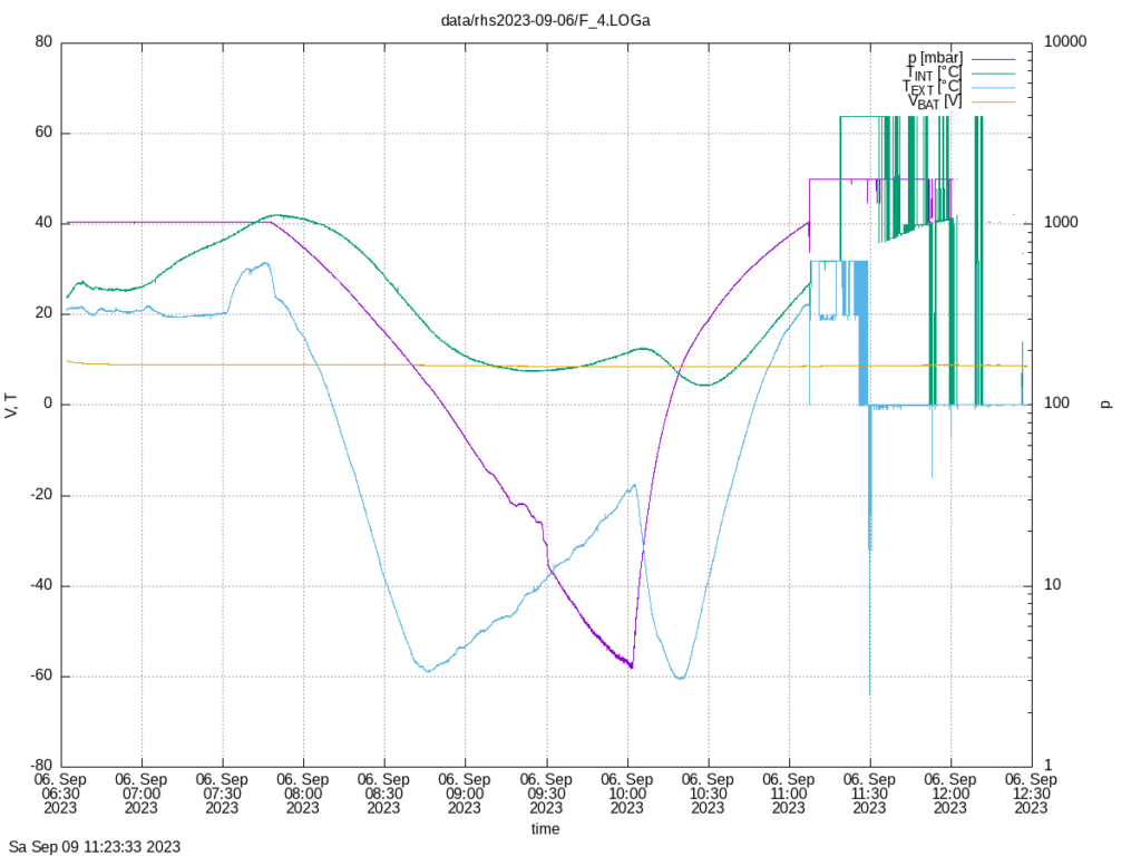
The pressure data shows a very remarkable feature. At a height between 20km and 30km the pressure did not fall monotonically. There were strange fluctuations. Seen here in purple, with the battery voltage in yellow, and inside (green) and outside (blue) temperatures.
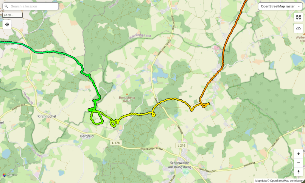
Looking at the GPS data, the strange fluctuations happened while the balloon was tumbling around the Bungsberg, the highest mountain of Schleswig-Holstein, at 168m.
So, what happened to the first two missions? The first mission landed sixty nautical miles west of Rømø. The balloon did not burst at all when it arrived at 40km height. It was floating at that height for another hour before it finally burst. It was found after a month by two girls in Sweden. All SDcards were readable in the end.
The second mission dropped down one nautical mile east of Schleimünde. We went to Maasholm, found a boat and recovered the box after a few hours. The video coverage was complete and showed how the crew of a sailing boat found the box, looked at it and put it back into the water. The big letters on the box read: “Safe Scientific Experiment”. The small print talked about recovery and phone numbers. The crew was afraid to disturb important measurements. The datalogger SDcard failed. The datalogger was later fixed. It turned out that a regulator was damaged by corrosion and put the full battery voltage to the SDcard, instead of a much lower supply voltage.